Challenge; How to adapt to changing climate in cities like Rio De Janeiro with a huge informal sector and increasing population when our data set is not sufficient enough to make a risk assessment.
Problem.
Did you know floods have caused over 12 million deaths between 1970 and 2012 in the world?(World Meteorological Organization,2021) In the past 10 years, floods have accounted for 80 to 90% of all natural disasters affecting a population of more than 2 billion worldwide (WHO, 2021)
Rio De Janeiro has been a hotspot of concern worldwide due to excessive flooding menace that has for long jeopardized development and wreck havocked livelihoods. Besides flooding, Rio is also vulnerable to landslides. The main cause is heavy rainfall whose frequency and magnitude has increased in the most recent years. For example on 29th February 2021, Mendanha weather station recorded 17.6 mm and 61.4 mm in 15 minutes and 1 hour respectively. Most hit areas include western metropolitan area of Rio including the western parts and Baixada fluminese areas of the state.
Citizens from many parts of the world face several issues apart from direct impacts of flooding. These challenges include lack of fair compensation by insurance companies, slowed economic growth due to repetitive mitigation by authorities as a result of repetitive disaster impacts and psychological stress due to avoidable flooding triggered by blocked sewer or stormwater systems.

There has been insufficient datasets on when and how big a flood is/was to make a risk assessment.
Proposed Solution and value addition.
Floodizens; meaning citizens for flood fights, is an application that will integrate a robust citizen science based early warning system and a decision support tool.

Existing datasets from meteorological stations and relevant authorities will be used for app development.
Focal citizens will be the main source of data for Floodizens after the app has been developed. Focal citizens will be chosen depending on their willingness and capability to participate in the activities, after having climate change awareness programs in the communities. These programs will be done through local media and workshops in the communities. The focal citizens will be trained on how to collect and upload data on Floodizens. Each Municipality in Rio De Janeiro will have focal citizens depending on the size of the municipality. The data to be collected by the focal citizens includes;
- Photos of blocked sewer/storm systems and ponding sites – Obtained by use of open cameras that have Geotagging capabilities/ Inbuilt GPS.
- Rainfall data and Temperature – Obtained by use of rain gauges and thermometers.
- Stream levels – Obtained by use of current meters.
- Flood levels – Obtained by use of stream gauges or sensors installed near water bodies and drainage channels.
The solution entries that will be provided by Floodizens to citizens or app users include;
- Daily weather forecasts to help citizens plan themselves on when and where to travel and what to wear.
- Seasonal weather forecasts to help the citizens plan themselves on when to prepare lands for planting and what to plant.
- Information on the location of evacuation points and the safest routes in case of flooding.
- Monitoring performance of sewer systems and stormwater infrastructure and their effects on flood genesis and control.
- Awareness and safety information on flooding including updates on safety actions and next steps.
- Citizens willing to invest in different parts of urban setups will democratically use the information to make decisions of whether to invest or not.
The solution entries that will be provided by Floodizens, to decision makers using results from the data input by focal citizens and other datasets include;
- Flooding vulnerability information to insurance agencies for purposes of flexible and fair compensation to the victims as well as building indices in their insurance packages.
- Information to investment companies on most flood prone areas including most potential areas to invest.
- The data use will also be used for urban planning to ensure vulnerable areas to flooding are extended with a hybrid approach to mitigation.
- Information to disaster risk reduction and disaster risk management companies about where , when and how big the flood was/is.
Novelty of Floodizens.
This concept assumes that Floodizens should ;
-Be cost- effective
-Be flexible for future robust developments
-A decision making tool as well as a data collection tool.
– Provide datasets that will help in making risk assessments.
– Help in disaster risk reduction and disaster risk management.
Main components of the project.


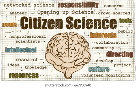
Citizen Science Data flow chain

Citizen science for flood monitoring in small watersheds
Despite many catchments having well-established hydrometric and meteorological observatory networks, many smaller but more responsive networks remain ungauged. This is true also for urban watersheds where hydrological processes have been short circuited by land conversion for settlements and infrastructure and expansion of urban fabric due to urbanization. It is thus empirically difficult to satisfactorily forecast or observe hydrological events such as floods in these set-ups using traditionally observatory and modelling approaches alone. This is because of the gaps that usually remain especially when it comes to capturing the fine details of peak discharges, onset of flash floods which in this case is beyond the capabilities of traditional river gauging stations (RGSs) and rainfall stations both in the spatial and temporal realms (Starkly et al. 2017). Community or citizen derived datasets have proofed to be of great value especially when it comes to spatial and temporal monitoring of localized flash floods. Usually, peak discharges responsible for flash flooding are under-estimated by ground based stations in terms of spatial coverage and it is within this scope that citizens come in handy. Further, citizen derived datasets is of value when it comes to ground truthing of extreme events. This does not only increase coverage of event monitoring but it also creates confidence during disaster management, integrated watershed management and watershed characterization.
Integrating citizen science and hydrology especially for flood mapping and disaster risk reduction is considered challenging because meteorological and hydrologic measurements are expensive, complex and requiring Spatio-temporal and well distributed measurements. However, current technological advancements of data collection equipments are improving flexibility of data quality and incorporation of data collected through the volunteer or citizen science platforms (Newman et al., 2012). The technology is also improving the rate at which various data such as rainfall, temperature and discharges is being collected through the local based systems or real-time mapping platforms (Paul et al., 2018). Citizen science initiates in many watersheds have been emerged the spatial coverage for monitoring purposes and disaster management has improved in the recent years. Examples of data collected by citizens include river water quality, discharges, precipitation, temperature and soil moisture (Miller-Rushing et al., 2012).
Business Model.
The business model is a social enterprise and the project is targeted for the entire population of Rio De Janeiro. However this is for a start, app design and development, piloting and scalability. Later, the application of this tool will be extended, modified for other cities or flood prone areas. Upscaling of Floodizens will target the world’s most vulnerable communities especially citizens in the informal sector, with an extended global coverage of flood prone areas.
The free app subscription will provide limited amount of data . The data to be provided includes; Daily weather forecasts, seasonal weather forecasts, evacuation points and the routes to follow incase of a flood, awareness and safety information on flooding including updates on safety actions and next steps.
The paid subscription which will be renewed annually will provide unlimited type of datasets. The data to be provided on top of the data provided by the free subscription option includes; Flooding vulnerability information to insurance agencies, Information to investment companies on most flood prone areas including most potential areas to invest, Information about vulnerable areas to flooding to urban planning authorities or any other necessary authorities.
Another source of revenue from the app will be through advertisements.
Source of revenue from sell of merchandise like caps, T- shirts, water bottles, umbrellas during major events that are related to world flooding e.g. World water day.
Who are we?
The idea behind development of Floodizens is an idea that was coined by five students coming from Kenya and Algeria under the supervision of Prof. John Gathenya. Prof John is a full professor at the Jomo Kenyatta University of Agriculture and Technology (JKUAT), at the department of soil, Water and Environmental Engineering. The team is composed of expertise from different backgrounds but with a commanding knowledge in the water sector and instrumentation. Details are as shown below.
The idea is steered forward between Team-Kenya 4 and the challenge owner-DTU- Rambøll (company) under a confidential and signed agreement
1.PROF. JOHN GATHENYA
Prof, Department of Soil, Water and Environmental Engineering
Jomo Kenyatta University of Agriculture, Science and Technology (JKUAT)

2.FEISAL HASSAN
BSc. Soil, Water and Environmental Engineering. MSc. Environmental Engineering and Management (Ongoing)
3.KIMAIYO JUNE JEROP
BSc. Control and Instrumentation. MSc. Environmental Engineering and Management (Ongoing)

4.NKENEN BRENDALINE SHIEKE
BSc. Agricultural Engineering. MSc. Water Engineering (Ongoing)

5.MAUREEN NDUKU MUTUNE
BSc. Water and Environmental Management (Ongoing)

6.KENNEDY WEKESA MURUNGA
BSc. Water Engineering, MSc. Water Science and Engineering (Hydrology and Water Resources), PhD. Civil Engineering (Ongoing).

REFERENCES.
Newman, G., Wiggins, A., Crall, A., Graham, E., Newman, S. & Crowston, K. (2012).The future of citizen science: emerging technologies and shifting paradigms. Front. Ecol. Environ. 10(6), 298–304. https://esajournals.onlinelibrary.wiley.com/doi/10.1890/110294
Paul, J.D., Buytaert, W., Allen, S., Ballesteros-Cánovas, J.A., Bhusal, J., Cieslik, K., Clark, J., Dugar, S., Hannah, D.M. & Stoffel, M. (2018). Citizen science for hydrological risk reduction and resilience building. Wiley Interdiscip. Wires. Water 5(1):1-15. https://onlinelibrary.wiley.com/doi/full/10.1002/wat2.1262
Starkey, E., Parkin, G., Birkinshaw, S., Large, A., Quinn, P. & Gibson, C., 2017. Demonstrating the value of community-based (‘citizen science’) observations for catchment model- ling and characterization. J. Hydrol. 548, 801–817.
https://www.sciencedirect.com/science/article/pii/S0022169417301646
Follow us


